
Geofence Design for Plants and Mines: Boundaries, Loading Points, Parking, and No-Go Zones
Most plants and mines that use GPS tracking already have geofences. Fewer have geofences they trust. A plant boundary drawn as a large circle catches trucks driving past on the highway. A single fence around the whole loading yard cannot tell which bay a truck used. A parking area that was never drawn makes waiting time invisible, so detention claims turn into arguments. In each case the tracking works; the drawing does not. This post covers how to draw geofences at plants and mines so the events they record match what actually happened.
Start with the events you need
A geofence is a tool for recording an event: a truck arrived, entered the gate, started loading, left the site. Before anyone opens a map, list the events your teams actually use, and who uses each one.
- Logistics: Arrival at site, gate entry, loading start and end, gate exit. These drive turnaround time and trips per vehicle.
- Finance: Waiting time outside the gate and time inside the plant. These decide detention claims and freight settlement.
- Security: Entry into areas trucks should not use, and long stops on the route.
- Stores and dispatch: Which loading or unloading bay a truck used, and when.
Each event needs a boundary drawn for that event. One fence rarely serves two purposes well. If the plant boundary is drawn wide to catch trucks on the approach road, it cannot also serve as the gate entry time. Draw two fences instead, and give each a clear name.
Mines and quarries: loading points that move
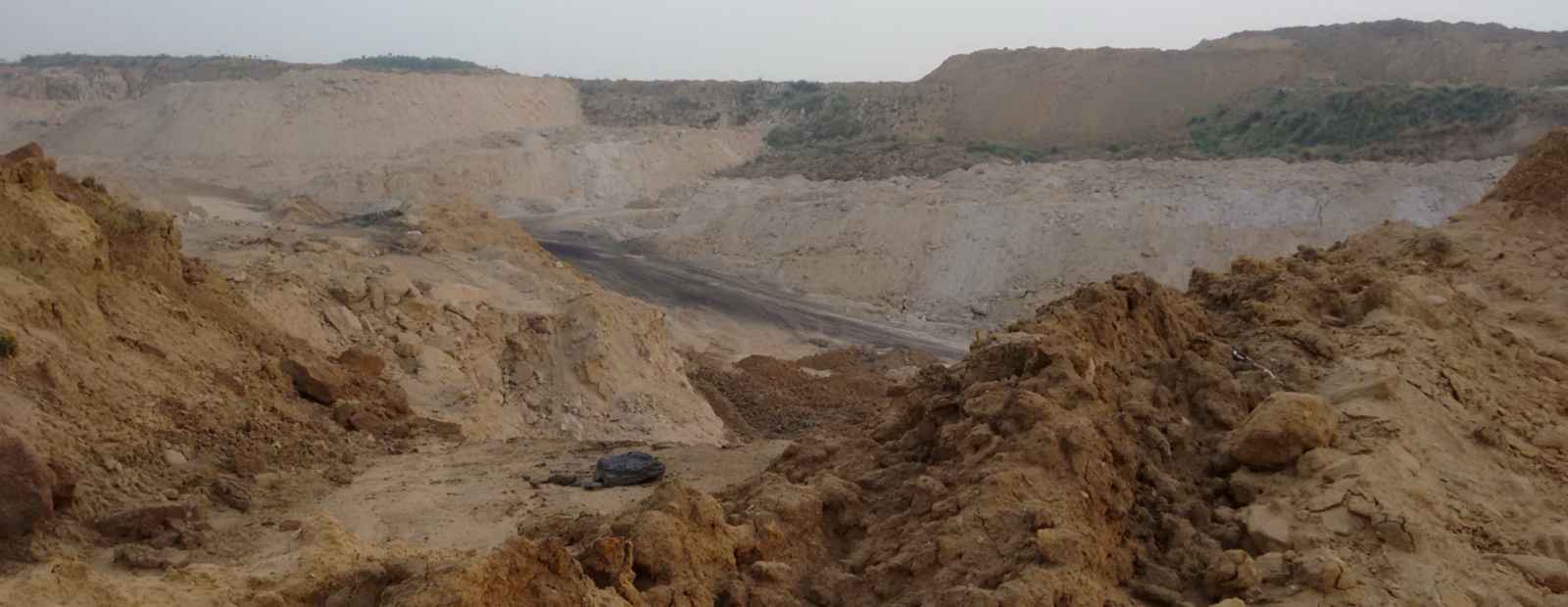
Mines are harder to fence than plants. The pit grows, benches shift, and loading points move as faces are worked. Haul roads are rerouted. A geofence drawn around last quarter's loading point may now sit over an empty bench, and trucks loading at the new face record no loading event at all.
- Fence the mine lease or site boundary once: This changes rarely and gives arrival and exit times for every trip.
- Fence active loading points separately: Keep them small, and name them by face or section so the mine team recognizes them.
- Review loading fences on a schedule: Tie the review to the mine plan, so new faces get a fence before trucks start loading there.
- Fence the mine weighbridge on its own: Loading weight and loading time should come from separate events, not one large fence.
- Allow for weak signals in deep pits: GPS positions can drift or drop near high walls. Use a minimum time inside a fence before an event counts, rather than reacting to a single position.
Plant boundaries, gates, and weighbridges
At a cement, steel, or power plant, the main fences follow the truck's path through the site. The goal is a clean sequence of events for every trip, with no gaps and no overlaps.
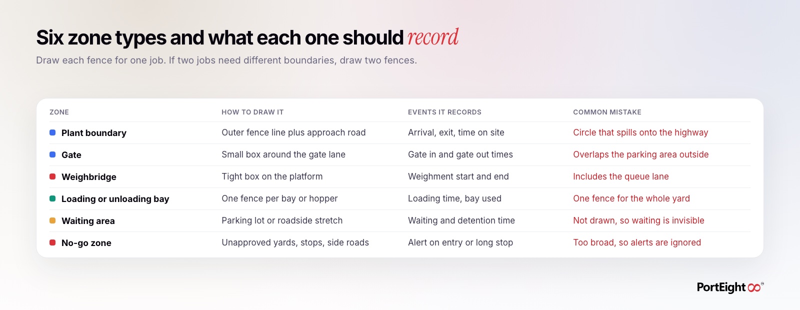
- Plant boundary: Follow the actual compound wall as a polygon, not a circle. Leave out public roads that run alongside the wall, or every passing truck will register as an arrival.
- Gate: Draw a small box around the gate lane itself. If the gate fence overlaps the parking area outside, trucks waiting in line will appear to be inside the plant.
- Weighbridge: Fence the platform tightly and keep the queue lane outside it. That way, the fence records weighment time, not queue time.
- Separate inbound and outbound gates: If the plant uses different gates for raw material and dispatch, fence them separately so each flow has its own times.
Where the plant runs a manless weighbridge, the weighbridge already records the vehicle and the time through RFID or number plate recognition. The geofence then serves as a cross-check: a weighment with no matching position on the platform deserves a second look.
Parking and waiting areas
Waiting time is often the least measured part of a truck's time at an industrial site. Trucks wait on the roadside, at a nearby dhaba, or in an informal parking lot before they are called to the gate. If those areas are not fenced, the system sees a truck that arrived at the boundary and then, much later, entered the gate, with no record of where the time went.
- Fence every place trucks actually wait: Ask gate and security staff where trucks park, then check GPS stoppage data to find places they did not mention.
- Keep waiting fences separate from the plant boundary: Waiting outside and time inside are different numbers, and finance needs both.
- Name them clearly: "North road parking" is more useful in a detention dispute than "Zone 7".
- Use the waiting area count: A live count of trucks in the waiting fence is an early sign of a gate or weighbridge bottleneck.
No-go zones and route corridors
No-go zones mark places a loaded truck should not stop or enter: unapproved yards, known spots for material diversion, side roads off the approved route, or restricted areas inside the plant. They are useful only if the alerts they raise get acted on.
- Be specific: A no-go zone covering a whole town will alert on every trip and soon be ignored. Fence the exact yard or stretch of road.
- Combine location with time: A stop of a few minutes at a fuel pump is normal. A long stop at an unapproved yard is not. Set a minimum stop time before the alert fires.
- Use route corridors for long hauls: A corridor along the approved route flags trucks that leave it, without fencing every possible detour.
- Assign an owner: Every no-go alert should go to a named person or team who will check it, not to a shared inbox.
Test, review, and maintain
Geofences are set up once and then often left alone for years. Sites change: new gates open, parking moves, loading bays are added, and mine faces advance. A short routine keeps the data reliable.
- Test with real trips: After drawing a fence, check a few completed trips and confirm the recorded times match gate registers or weighbridge slips.
- Look for trips with missing events: A trip with an exit but no entry, or loading with no weighment, usually points to a fence in the wrong place.
- Review after site changes: Any new gate, road, bay, or parking area should trigger a geofence update.
- Keep a simple register: Record each fence's name, purpose, owner, and last review date.
How PortEight helps
PortEight combines GPS fleet tracking and geofencing in one central dashboard. Operations teams can draw separate fences for plant boundaries, gates, weighbridges, loading and unloading bays, waiting areas, and no-go zones, and each fence records entry, exit, and time inside for every tracked truck, owned or hired.
Those events sit on the same trip record as the weighment. PortEight's manless weighbridge automation identifies trucks by RFID or camera-based number plate recognition and records weights directly, so weighbridge times and geofence times can be checked against each other. Vehicle and driver documents can be verified through Parivahan and Sarathi before trucks reach the gate. Waiting time and time on site then flow into digital freight orders, invoicing, and payments, so detention and freight are settled on recorded times rather than estimates.
Take control of your logistics
operations in real time
Automate tracking, optimize movement, and eliminate delays across your entire supply chain.
Contact Us